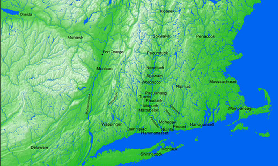
Mohegan Environs
This map illustrates the Indigenous territory that now constitutes southern New England, highlighting the tribal communities located along the Kwinitekw (Connecticut River) while also noting some of the other surrounding tribal nations.
Map created by Jenny Davis and Lisa Brooks, using ArcGIS 9.2, courtesy of Harvard University.
From Lisa Brooks, The Common Pot: the Recovery of Native Space in the Northeast (University of Minnesota Press 2008).
For more information, see: https://lbrooks.people.amherst.edu/thecommonpot/map7.html
From Lisa Brooks, The Common Pot: the Recovery of Native Space in the Northeast (University of Minnesota Press 2008).
For more information, see: https://lbrooks.people.amherst.edu/thecommonpot/map7.html
